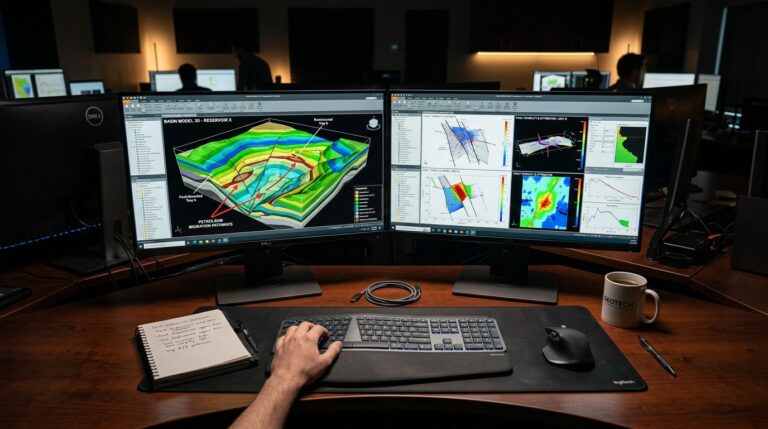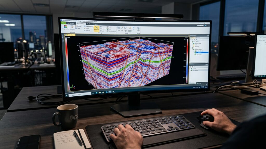
In the complex field of subsurface exploration, geologists and geophysicists require advanced tools to extract meaningful insights from vast datasets. Geomodeling Attribute Studio, a specialist software in the Geology, Seismic Interpretation & Basin Modeling category, provides capabilities for detailed seismic attribute computation, analysis, and AI-assisted interpretation. This article delves into the core functions and differentiating aspects of Geomodeling Attribute Studio, helping professionals assess its fit for their specific subsurface characterization and interpretation workflows.
Need This Software?
Contact us to request the software and receive download and access information.
The challenges of identifying subtle geological features and accurately delineating reservoir properties necessitate sophisticated analytical methods. Attribute Studio is designed to address these requirements by offering a comprehensive suite for attribute generation, AI-driven facies classification, and multi-attribute visualization, aimed at enhancing the precision and efficiency of seismic interpretation projects.
Key Facts
- Category: Geology, Seismic Interpretation & Basin Modeling
- Best for: Geologists and Geophysicists working in petroleum and energy exploration and production.
- Also compare: CGG InsightEarth, Geoteric, HampsonRussell Geoview
Core Capabilities for Advanced Subsurface Characterization
Geomodeling Attribute Studio offers a suite of functionalities designed to enhance the understanding of geological structures and properties through seismic data analysis. These tools are tailored to support interpreters in making more informed decisions by revealing subtle patterns and anomalies.
Seismic Attribute Computation and Analysis
The software provides a comprehensive environment for generating and analyzing a wide array of seismic attributes. These attributes are crucial for highlighting geological features that might not be apparent in raw seismic data, such as faults, fractures, and stratigraphic boundaries.
- Extensive library of pre-defined seismic attributes
- Tools for custom attribute definition and computation
- Advanced analytical workflows to extract quantitative insights from attributes
AI-Assisted Stratal Slicing and Facies Classification
Leveraging artificial intelligence, Geomodeling Attribute Studio enhances the efficiency and accuracy of geological interpretation tasks. Its AI capabilities are specifically applied to stratal slicing and the classification of subsurface facies, which are critical for reservoir characterization.
- Machine learning algorithms for automated stratal interpretation
- AI-driven tools for objective and consistent facies identification
- Reduction of manual interpretation time and effort through intelligent automation
Multi-Attribute Visualization
Understanding complex geological relationships often requires viewing multiple data types simultaneously. Geomodeling Attribute Studio provides robust visualization tools that allow for the integrated display of various seismic attributes and interpretive results.
- Integrated environment for displaying multiple seismic attributes concurrently
- Capabilities for 2D, 3D, and 4D visualization of subsurface data
- Enhanced perception of geological patterns and anomalies through combined visual cues
Data Exchange and Platform Integration
To ensure seamless workflow integration, Geomodeling Attribute Studio is designed to interoperate with other leading interpretation platforms. This capability facilitates the smooth exchange of seismic data, attributes, and interpretation results, maintaining continuity across different software environments.
- Seamless import and export functionalities with industry-standard data formats
- Compatibility with major interpretation platforms used in E&P projects
- Streamlined project workflows by enabling data flow between specialized applications
The Geomodeling Attribute Studio Advantage: Combining Pedigree with AI
What sets Geomodeling Attribute Studio apart in a competitive landscape is its deep-rooted expertise in attribute analysis, built upon over 20 years of continuous development, now strategically repositioned with modern AI capabilities under the subsurfaceAI brand. This combination offers users a tool that benefits from a long history of specialized attribute-analysis refinement alongside cutting-edge artificial intelligence, providing both reliability and innovation in subsurface interpretation.
How Geomodeling Attribute Studio Fits into Your Workflow
For geologists and geophysicists engaged in detailed seismic interpretation, reservoir characterization, and geological modeling, Geomodeling Attribute Studio provides a focused solution for extracting critical information from seismic data. Its specialized tools, from advanced attribute computation to AI-driven facies classification, aim to accelerate interpretation cycles and improve the accuracy of subsurface models.
| Product | Category | Key Strengths |
|---|---|---|
| Geomodeling Attribute Studio | Geology, Seismic Interpretation & Basin Modeling | Specialized seismic attribute computation, AI-assisted interpretation, multi-attribute visualization, deep attribute-analysis pedigree |
| CGG InsightEarth | Geology, Seismic Interpretation & Basin Modeling | — |
| Geoteric | Geology, Seismic Interpretation & Basin Modeling | — |
| HampsonRussell Geoview | Geology, Seismic Interpretation & Basin Modeling | — |
Frequently Asked Questions (FAQs)
How does Geomodeling Attribute Studio enhance seismic interpretation workflows?
Geomodeling Attribute Studio enhances seismic interpretation workflows through a comprehensive suite of tools for advanced seismic attribute computation, AI-assisted stratal slicing and facies classification, and robust multi-attribute visualization, leading to more informed and efficient interpretation.
What role does AI play in Attribute Studio for facies classification?
AI plays a significant role in Attribute Studio by providing machine learning algorithms for automated stratal interpretation and AI-driven tools for objective and consistent facies identification, which helps reduce manual interpretation time and effort.
Can Geomodeling Attribute Studio integrate with existing seismic interpretation platforms?
Yes, Geomodeling Attribute Studio is designed for seamless data exchange. It offers import and export functionalities with industry-standard data formats and maintains compatibility with major interpretation platforms used in E&P projects.
What types of seismic data can be processed using Attribute Studio?
Geomodeling Attribute Studio is capable of processing seismic data to generate and analyze various attributes, revealing geological features and aiding in subsurface characterization.
How does Attribute Studio support multi-attribute visualization for geological analysis?
Attribute Studio supports multi-attribute visualization through an integrated environment that allows for the concurrent display of multiple seismic attributes in 2D, 3D, and 4D. This enhances the perception of complex geological patterns and anomalies through combined visual cues.
Need Access to This Software?
Need this software for your project? Contact us for download access, availability, and related information.
Conclusion
Geomodeling Attribute Studio offers a robust and specialized toolkit for geologists and geophysicists focused on advanced seismic attribute analysis and AI-driven subsurface insights. Its long history of development combined with modern AI integration makes it a compelling option for detailed geological characterization. To explore how Geomodeling Attribute Studio can integrate with your seismic interpretation workflows and enhance your subsurface understanding, submit an inquiry through our site’s request form.