Understanding subsurface structures and properties is fundamental to exploration and production within the oil and gas industry. For Geologists and Geophysicists, the precision and efficiency of seismic interpretation software are critical. This article provides a detailed overview of Geoteric, an interpretation platform designed to address these complex challenges with a focus on advanced attribute analysis and artificial intelligence.
Need This Software?
Contact us to request the software and receive download and access information.
The platform supports professionals in making informed decisions for exploration and reservoir characterization by enabling detailed analysis of seismic data. Geoteric aims to enhance geological understanding through its specialized approach to processing and visualizing subsurface information.
Key Facts
- Category: Geology, Seismic Interpretation & Basin Modeling
- Best for: Geologist / Geophysicist
- Also compare: CGG InsightEarth, dGB Earth Sciences OpendTect
What is Geoteric Software?
Geoteric is a software platform developed for seismic interpretation and basin modeling, aimed at enhancing the understanding of subsurface geological features. It provides tools for detailed analysis of seismic data, enabling professionals to make informed decisions for exploration and reservoir characterization. The platform is continuously developed, reflecting ongoing advancements in interpretation technology.
Core Interpretation Philosophy: Attribute-First and AI-Driven
Geoteric distinguishes itself through an interpretation philosophy that prioritizes attribute-first analysis, complemented by artificial intelligence. Unlike traditional approaches where AI might serve as a secondary add-on to pick-based workflows, Geoteric integrates AI capabilities directly into its core attribute-driven methodology. This approach aims to streamline the interpretation process, enabling more rapid and accurate identification of geological features, such as horizons and faults, through data patterns rather than manual picking alone.
Key Capabilities for Seismic Interpretation
The Geoteric platform offers a suite of features engineered to support comprehensive seismic interpretation workflows. These capabilities are designed to provide a robust environment for geoscientists to analyze, visualize, and interpret complex seismic data.
Seismic Attribute-Driven Interpretation
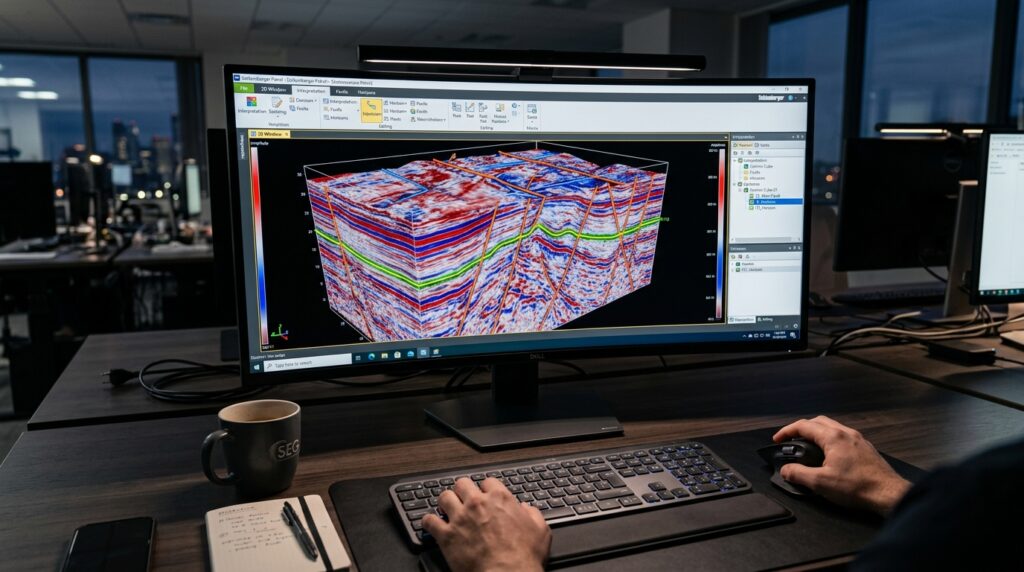
A cornerstone of Geoteric’s functionality is its extensive support for seismic attribute-driven interpretation. This capability allows users to extract and analyze various attributes from seismic data, revealing subtle geological features that may not be apparent in raw seismic amplitudes. The software provides a framework for generating, computing, and visualizing attributes that highlight discontinuities, stratigraphy, and other subsurface characteristics, thereby improving the accuracy and efficiency of interpretation.
AI/Machine-Learning-Assisted Horizon and Fault Picking (“AI Horizons”)
Geoteric integrates advanced artificial intelligence and machine learning algorithms, notably through its “AI Horizons” module, to assist in the interpretation of horizons and faults. This feature uses AI to learn from user-defined interpretations or existing data, automating significant portions of the picking process. It helps to accelerate the mapping of geological surfaces and fault networks, reducing manual effort and enhancing consistency across large datasets. The AI-driven approach is particularly valuable for complex geological settings where manual interpretation can be time-consuming and prone to variability.
RGB Blending and Colour-Based Stratal Analysis
The software includes powerful visualization tools such as RGB blending and colour-based stratal analysis. RGB blending allows geoscientists to combine multiple seismic attributes into a single composite image, where each attribute is mapped to a red, green, or blue color channel. This technique enhances the visual distinction of geological features and helps in identifying subtle variations in stratigraphy or lithology. Colour-based stratal analysis further aids in understanding depositional environments and sequence stratigraphy by visualizing seismic reflections in a geologically meaningful color scheme.
Cloud-Deployable Interpretation Workflows
Recognizing the evolving needs of modern E&P operations, Geoteric supports cloud-deployable interpretation workflows. This capability provides flexibility for teams to access and work with seismic data and interpretation projects from various locations, facilitating collaboration and scalable computing resources. Cloud deployment helps in managing large datasets efficiently and enables dynamic adjustments to computing power as project demands fluctuate.
Comparative Overview: Geoteric and Competing Solutions
Understanding how Geoteric stands in relation to other tools in the market can help geoscientists evaluate its fit for their specific needs. petroleumsoftware.ir lists several competing products in the Geology, Seismic Interpretation & Basin Modeling category.
| Product Name | Category | Key Differentiator (Geoteric) |
|---|---|---|
| Geoteric | Geology, Seismic Interpretation & Basin Modeling | Attribute-first, AI-assisted seismic interpretation at its core. |
| CGG InsightEarth | Geology, Seismic Interpretation & Basin Modeling | — |
| dGB Earth Sciences OpendTect | Geology, Seismic Interpretation & Basin Modeling | — |
| IKON RokDoc | Geology, Seismic Interpretation & Basin Modeling | — |
Applications and Benefits for Geoscientists
For Geologists and Geophysicists, the functionalities offered by Geoteric translate into several practical benefits across various stages of the E&P lifecycle:
- Accelerated Interpretation: AI-assisted picking of horizons and faults significantly reduces the time required for manual interpretation, allowing for quicker turnaround on projects.
- Enhanced Geological Understanding: Advanced seismic attribute analysis and RGB blending provide deeper insights into subsurface geology, helping to identify complex structures, facies changes, and reservoir characteristics.
- Improved Accuracy and Consistency: The integration of AI helps in maintaining consistency in interpretation across large datasets and complex geological environments, reducing subjective biases.
- Collaborative Workflows: Cloud-deployable capabilities facilitate team collaboration and enable remote access to projects, enhancing operational flexibility.
- Risk Mitigation: More detailed and accurate subsurface models derived from advanced interpretation can contribute to better decision-making, potentially mitigating exploration and development risks.
Frequently Asked Questions About Geoteric Software
What are the primary interpretation methods supported by Geoteric?
Geoteric primarily supports attribute-driven interpretation, complemented by AI/machine learning assistance for horizons and faults, and advanced visualization techniques like RGB blending and color-based stratal analysis.
How does Geoteric’s AI module assist in geological interpretation?
Geoteric’s AI module, “AI Horizons,” assists by learning from user-defined interpretations or existing data to automate significant portions of horizon and fault picking. This helps accelerate mapping and enhances consistency across large datasets.
Can Geoteric be used for both exploration and development projects?
Yes, Geoteric is designed for detailed analysis of seismic data, making it suitable for both exploration (identifying new prospects) and development (reservoir characterization and understanding existing fields) projects.
What types of seismic attributes can be generated and analyzed within the software?
Geoteric supports the generation, computation, and visualization of various seismic attributes that highlight discontinuities, stratigraphy, and other subsurface characteristics, improving the accuracy and efficiency of interpretation.
How does Geoteric support collaborative workflows for interpretation teams?
Geoteric supports collaborative workflows through its cloud-deployable capabilities, which allow interpretation teams to access and work with seismic data and projects from various locations, facilitating shared access and dynamic adjustments to computing resources.
Need Access to This Software?
Need this software for your project? Contact us for download access, availability, and related information.
Conclusion
Geoteric is particularly well-suited for Geologists and Geophysicists who prioritize an attribute-first approach to seismic interpretation and seek to leverage artificial intelligence for accelerating workflows and enhancing geological understanding. Its core differentiation lies in integrating AI directly into attribute-driven methodologies, moving beyond traditional pick-based systems. To explore how Geoteric can integrate with your specific seismic interpretation projects or to request more detailed information, please submit an inquiry through the petroleumsoftware.ir form.