Geologists and geophysicists engaged in oil and gas exploration and production face the challenge of accurately interpreting vast 3D seismic datasets to unlock subsurface insights. Landmark GeoProbe addresses this directly, serving as a specialized engine within the Landmark (Halliburton) portfolio, dedicated to high-performance 3D seismic volume interpretation and visualization. It provides a robust environment essential for analyzing complex geological structures and stratigraphic features in full three dimensions.
Need This Software?
Contact us to request the software and receive download and access information.
This article explores GeoProbe’s focused capabilities, highlighting its design for efficient handling of extensive seismic volumes and its role in modern geosciences workflows. We will detail how its tools support intricate subsurface analysis, differentiating it as a core component for advanced interpretation tasks rather than a general-purpose platform.
Key Facts
- Category: Geology, Seismic Interpretation & Basin Modeling
- Best for: Geologist / Geophysicist
Understanding Landmark GeoProbe’s Core Purpose
As Landmark’s dedicated 3D-volume visualization and interpretation engine, GeoProbe is central to workflows that require deep analysis of seismic data. It moves beyond 2D or map-centric interpretations, offering a powerful platform for understanding the subsurface in its full three-dimensional context. GeoProbe is often utilized within or alongside DecisionSpace workflows, providing specialized capabilities for intricate geological and geophysical studies.
Key Capabilities for Seismic Interpretation
Landmark GeoProbe equips geoscientists with specific tools tailored for detailed volume analysis:
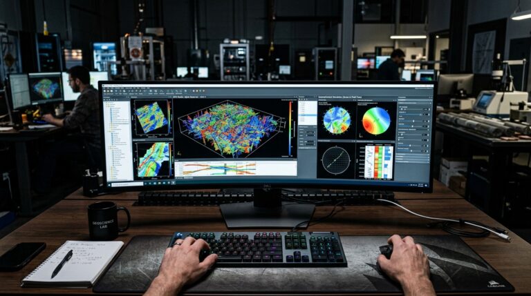
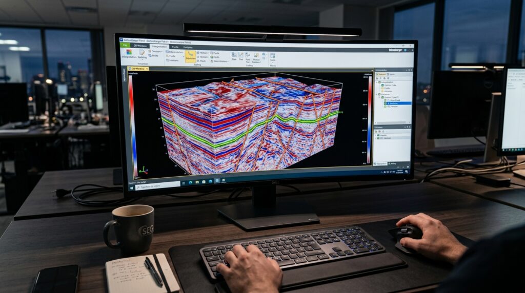
- Seismic Volume Visualization and Voxel-Based Interpretation: GeoProbe enables high-fidelity rendering of seismic volumes, allowing for direct, interactive interpretation within the 3D space using voxel data. This capability supports a comprehensive understanding of geological features and seismic responses throughout the volume.
- Multi-Attribute and Multi-Survey Volume Rendering: The software facilitates the simultaneous visualization of multiple seismic attributes and surveys. This feature is critical for integrating diverse data types and identifying subtle anomalies or patterns that might not be evident in single-attribute views.
- Automated Fault and Horizon Tracking: GeoProbe provides advanced algorithms for auto-tracking faults and horizons across full 3D seismic volumes. These tools significantly enhance interpretation efficiency and consistency, particularly in structurally complex areas.
Integration with Geosciences Workflows
GeoProbe’s design prioritizes seamless integration, particularly within the broader DecisionSpace Geosciences ecosystem. This integration ensures that interpretations performed in GeoProbe can be readily shared and utilized in other stages of the E&P workflow, such as geological modeling, reservoir characterization, and well planning. Its role as a specialized engine means it complements other geosciences applications by providing advanced 3D interpretation capabilities where they are most needed.
What Differentiates Landmark GeoProbe?
GeoProbe stands out as Landmark’s specialized engine for 3D-volume interpretation and visualization. Its key differentiator is its long-standing recognition for efficiently handling very large seismic volumes. The software leverages GPU-accelerated rendering to deliver fast and responsive performance, enabling geoscientists to interact with extensive datasets without significant performance bottlenecks. This focus on 3D volume handling and performance positions GeoProbe as a powerful tool for demanding interpretation tasks.
Related Software in Seismic Interpretation
The field of seismic interpretation involves a range of software solutions, each with specific strengths. Understanding how Landmark GeoProbe fits within this landscape can aid in software selection. Below is a comparison of GeoProbe with some related products often used in similar workflows.
| Product Name | Category |
|---|---|
| Landmark GeoProbe | Geology, Seismic Interpretation & Basin Modeling |
| Landmark DecisionSpace Geosciences | Geology, Seismic Interpretation & Basin Modeling |
| Schlumberger Petrel | Geology, Seismic Interpretation & Basin Modeling |
| Geoteric | Geology, Seismic Interpretation & Basin Modeling |
Frequently Asked Questions about Landmark GeoProbe
Below are common questions regarding the capabilities and application of Landmark GeoProbe in geological and geophysical workflows.
What are the primary applications of Landmark GeoProbe in exploration and production?
Landmark GeoProbe is primarily applied in exploration and production for advanced 3D seismic volume interpretation and visualization, supporting the analysis of complex subsurface structures, voxel-based interpretation, and automated fault and horizon tracking for comprehensive geological and geophysical studies.
How does GeoProbe enhance 3D seismic volume interpretation compared to other tools?
GeoProbe enhances 3D seismic volume interpretation through its dedicated design as a 3D-volume visualization and interpretation engine. It is recognized for efficiently handling very large seismic volumes and utilizes GPU-accelerated rendering to provide fast and responsive performance, allowing geoscientists to interact with extensive datasets without significant bottlenecks.
What types of seismic data can be visualized and interpreted using GeoProbe?
GeoProbe is designed to visualize and interpret 3D seismic volumes. It supports multi-attribute and multi-survey volume rendering, enabling the integration and analysis of diverse seismic data types and attributes, including direct, interactive interpretation within the 3D space using voxel data.
How does GeoProbe integrate with other Halliburton Landmark software solutions?
GeoProbe is designed for seamless integration within the broader DecisionSpace Geosciences ecosystem. This integration facilitates the sharing and utilization of interpretations across different stages of the E&P workflow, such as geological modeling, reservoir characterization, and well planning, complementing other geosciences applications.
Is GeoProbe suitable for both structural and stratigraphic interpretation?
Yes, GeoProbe is suitable for both structural and stratigraphic interpretation. Its capabilities for analyzing complex subsurface structures, auto-tracking faults, and enabling a comprehensive understanding of geological features and seismic responses within the 3D volume support both types of interpretation workflows.
Need Access to This Software?
Need this software for your project? Contact us for download access, availability, and related information.
Conclusion
Landmark GeoProbe serves as a critical software solution for geologists and geophysicists requiring advanced 3D seismic volume visualization and interpretation. Its capabilities in handling large datasets, performing multi-attribute rendering, and facilitating automated tracking make it an invaluable tool for comprehensive subsurface analysis within the E&P industry. To discover how Landmark GeoProbe can specifically address your project needs, please submit an inquiry through petroleumsoftware.ir’s request form.