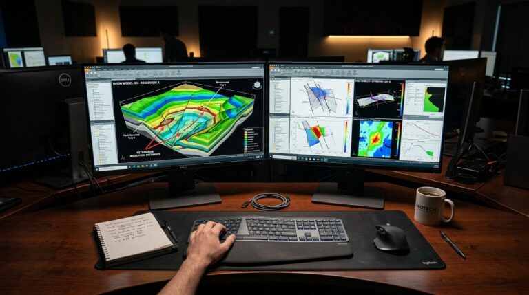
Understanding the subsurface is foundational for successful petroleum exploration and production. Geologists and geophysicists rely on advanced software platforms to build comprehensive reservoir models that accurately represent complex geological structures and fluid distributions. RMS, part of AspenTech’s Subsurface Science and Engineering division, is a flagship platform designed for detailed 3D geological and reservoir modeling.
Need This Software?
Contact us to request the software and receive download and access information.
This article provides a focused technical overview of RMS, emphasizing its geostatistics-first modeling approach and its role within the AspenTech Subsurface Science and Engineering ecosystem. It aims to help practitioners differentiate RMS from other reservoir modeling platforms and determine its suitability for specific reservoir characterization and development workflows.
Key Facts
- Category: Reservoir Modeling Platform
- Best for: Geologist / Geophysicist
- Also compare: Schlumberger Petrel, SKUA GOCAD
RMS: A Geostatistics-First Approach to Reservoir Modeling
RMS is recognized as a dominant reservoir modeling platform, distinguished by its strong foundation in a geostatistics-first modeling approach. This methodology prioritizes statistical rigor in the characterization of subsurface properties, offering robust tools for building detailed and realistic models from seismic, well, and geological data.
The software provides capabilities essential for comprehensive subsurface analysis, enabling professionals to construct accurate representations of reservoir geology and fluid dynamics. Its core strengths lie in:
- 3D Geological and Reservoir Modeling: Build high-resolution geological frameworks, incorporating structural, stratigraphic, and facies interpretations to create integrated reservoir models.
- Geostatistical Facies and Petrophysical Property Modeling: Leverage advanced geostatistical algorithms to model complex facies distributions and petrophysical properties (e.g., porosity, permeability, water saturation) throughout the reservoir, accounting for spatial variability and uncertainties.
- Uncertainty and Volumetrics Workflows: Conduct comprehensive uncertainty analysis to quantify geological and petrophysical risks. Calculate reliable hydrocarbon volumes and evaluate potential development scenarios under varying uncertainties.
- Well Planning and Reservoir Monitoring Integration: Integrate modeling results directly into well planning processes, optimizing drilling trajectories and completion strategies. The platform also facilitates the assimilation of dynamic reservoir data for ongoing reservoir monitoring and management.
The Advantage of a Geostatistics-First Philosophy
RMS’s emphasis on geostatistics from the outset allows for a more rigorous and data-driven approach to subsurface characterization. This is particularly valuable for complex and heterogeneous reservoirs, where accurately capturing spatial variations and uncertainties is critical for reliable resource estimation and development planning. This approach helps in:
- Minimizing subjective bias in model construction.
- Quantifying uncertainties associated with reservoir properties.
- Generating multiple equiprobable realizations for robust risk assessment.
Uncertainty, Volumetrics, and Integrated Workflows
A critical aspect of reservoir characterization is the management of uncertainty. RMS offers comprehensive workflows for propagating uncertainties from input data through to reservoir performance predictions. This includes:
- Probabilistic volumetrics calculations, providing P10, P50, and P90 estimates.
- Scenario-based modeling to explore different geological interpretations.
The integration capabilities extend beyond static modeling. The platform supports dynamic data integration, enabling geologists and geophysicists to incorporate production data, time-lapse seismic, and other monitoring results back into their models. This creates a living model that evolves with new information, supporting adaptive reservoir management strategies.
Leveraging the AspenTech Ecosystem
As part of AspenTech’s Subsurface Science and Engineering division, RMS benefits from integration within a broader ecosystem focused on process and asset optimization. This corporate lineage provides a pathway for subsurface insights to inform upstream, midstream, and downstream operations, fostering a more holistic approach to energy asset management.
Overview of RMS Capabilities
| Capability Area | Key Features Provided by RMS |
|---|---|
| 3D Modeling | Geological frameworks, structural interpretation, stratigraphic layering, detailed reservoir geometries |
| Property Modeling | Geostatistical facies modeling, petrophysical property distribution (porosity, permeability, saturation) |
| Risk & Uncertainty | Uncertainty analysis workflows, probabilistic volumetrics, scenario generation |
| Integration | Well planning optimization, reservoir monitoring data assimilation |
Related Software in the Subsurface Landscape
The subsurface modeling domain features several powerful platforms. RMS stands as one of the two dominant reservoir-modeling platforms. Other notable solutions in this category include Schlumberger Petrel, which shares a similar market presence. Within AspenTech’s own Subsurface Science and Engineering portfolio, products like SKUA GOCAD offer complementary capabilities in geological modeling. JewelSuite also provides advanced tools for reservoir characterization.
FAQ
What are the primary applications of RMS software in oil and gas?
RMS is primarily used for 3D geological and reservoir modeling, including geostatistical facies and petrophysical property modeling, uncertainty and volumetrics workflows, well planning, and reservoir monitoring.
How does RMS handle geological uncertainty in reservoir models?
RMS provides comprehensive workflows for propagating uncertainties from input data, offering probabilistic volumetrics calculations (P10, P50, P90 estimates), scenario-based modeling, and the generation of multiple equiprobable realizations for risk assessment.
Can RMS integrate well data and seismic interpretations?
Yes, RMS builds detailed models by integrating seismic, well, and geological data. It also supports dynamic data integration, allowing for the incorporation of production data and time-lapse seismic results.
What makes RMS’s geostatistics-first approach distinct from other modeling tools?
The geostatistics-first approach in RMS emphasizes statistical rigor from the outset, leading to data-driven subsurface characterization. This minimizes subjective bias, accurately quantifies uncertainties, and enables the generation of multiple equiprobable reservoir realizations for robust risk assessment.
How does RMS support long-term reservoir management?
RMS supports long-term reservoir management by integrating modeling results directly into well planning processes and facilitating the assimilation of dynamic reservoir data for ongoing monitoring. This enables the creation of evolving models that support adaptive reservoir management strategies.
Need Access to This Software?
Need this software for your project? Contact us for download access, availability, and related information.
Conclusion
RMS is best suited for geologists and geophysicists who require a robust, data-driven, and geostatistics-first approach to complex reservoir modeling. Its comprehensive capabilities in 3D geological and property modeling, coupled with advanced uncertainty and volumetrics workflows and integration into the broader AspenTech ecosystem, make it a strong contender for detailed subsurface characterization and optimized development planning. To determine if RMS is the precise solution for your geological and geophysical modeling challenges, submit an inquiry through petroleumsoftware.ir’s request form for a detailed discussion.